


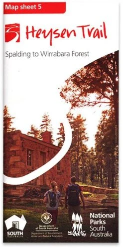

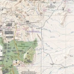
Heysen Trail Map 5 Spalding−Wirrabara
Original price was: $14.90.$10.43Current price is: $10.43.
- Shop with confidence, enjoy free returns.
- Streamlined service, designed for your convenience.
- Multiple safe payment methods
- Fast, friendly, always here to help.

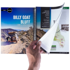
With some guidance from the Heysen Trail Sheet Map 5, you’ll be able to push on with your hiking adventure from Spalding to Wirrabara Forest.
This map is at a scale of 1:50 000 and is made from double sided water-resistant paper. This section of the trail takes you through the rolling hills, cleared landscapes, the catchment of the Bundaleer Reservoir, and eventually, you’ll glimpse some views of the Spencer Gulf in the west.
It also gives you information on supplies and facilities, where the accommodation and campsites are, the loop trails in national parks, important contact information, and some advice for staying safe. Keep going on your long-distance walk with the Heysen Trail Sheet Map 5.
- 1:50000 scale (1cm = 500m)
- Double-sided water-resistant paper
- Elevation profiles with km markers and crossing points names
- Loop trails in national parks
- Location of supplies and facilities
- Important contact details
- Accommodation and campsites
- Advice on walking and safety
Be the first to review “Heysen Trail Map 5 Spalding−Wirrabara”
Related products
Camping Accessories
Camping Accessories

Camping Accessories

Camping Accessories

Camping Accessories
Camping Accessories
Camping Accessories


Camping Accessories
Reviews
There are no reviews yet.